Hello,
Welcome to the latest edition of Branches, ATREE's quarterly newsletter! We are excited to share updates and insights from our diverse range of projects. Explore the innovative approaches and impactful findings that define our ongoing research. Join us on this journey through the branches of knowledge as we strive to make a meaningful impact on the environment and society. |
|
|
|---|
|
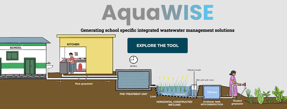
PROJECT AquaWISE – Evidence-based decision support tool for implementing site-specific greywater treatment solutions for schools in arid and semi-arid regions by Priyanka Jamwal and Durba Biswas. |
|
|---|
|
| | | | | |  | | | | | | | | | |
| BACKGROUND
Government schools in the arid and semi-arid region in Deccan India are grappling with water security issues. The absence of wastewater management exposes children to health risks, while inadequate water supply for sanitation leads to unhygienic conditions, which disproportionately and negatively impact girls.
PROBLEM
Our project focuses on government schools in semi-arid southern India. These schools have access to fewer resources and are particularly vulnerable to wastewater-related health risks while also experiencing irregular freshwater supplies. Treating greywater (generated from kitchens, bathrooms and cleaning) at these schools can reduce human and environmental health risks and dependency on freshwater sources.
Baseline data on local water and wastewater quality and supply are crucial for designing location-specific treatment systems.
However, early efforts at collecting school-level data on wastewater contaminant profiles continue to be sporadic and concentrated in the global north. Moreover, collecting data on wastewater contaminant load from schools is expensive and resource-intensive.
OUTCOME Therefore, AquaWISE was developed as an evidence-based decision support tool for the optimal deployment of Nature-based Solutions (NbS) for greywater treatment in schools. The tool can minimise or eradicate the need for costly and time-consuming baseline data collection while generating school-specific wastewater treatment NbS. AquaWISE allows users to select from a menu of treatment options based on their desired end-use of treated water. The webtool requires minimal input from the users. The users are expected to know the region (urban, rural, peri-urban), type of school (lower primary, higher primary, or high school), the sources of water supply (public supply or private supply), the number of children and adults in the school, if they have an operational kitchen and the size of vacant land available within the school compound. Finally, the users have to select the final use of the treated greywater (treat and release OR treat and reuse for flushing or irrigation). AquaWISE then generates the school-specific design parameters and the guiding CAPEX costs for the best-suited treatment systems ranked by their area requirements. Users can learn more about each of the suggested interventions by going through the ‘know more’ tab.
The AquaWISE offers a user-friendly solution for practitioners and policymakers to select appropriate wastewater treatment and reuse options for schools. The algorithm translates minimal user input data into output tables (showing treatment option with guiding CAPEX estimates), matching school requirements regarding the available area and intended water use. By utilising this tool, practitioners can effectively tackle water security issues in schools. For future research, there is potential to extend the applicability of AquaWISE in different types of settings such as mountainous regions and regions with well-drained alluvial regions. | | |
|
|
|
|---|
|
|
PROJECT Deshnok Oran: Restoring an Ancient Sacred Grove for People and Biodiversity in Rajasthan by Karni Singh Bithoo, Shubham Kalwani, Chetan Mishr, Ranjni T.S., Khushboo Singla, Anuja Malhotra and Abi Vanak | | | | | | | 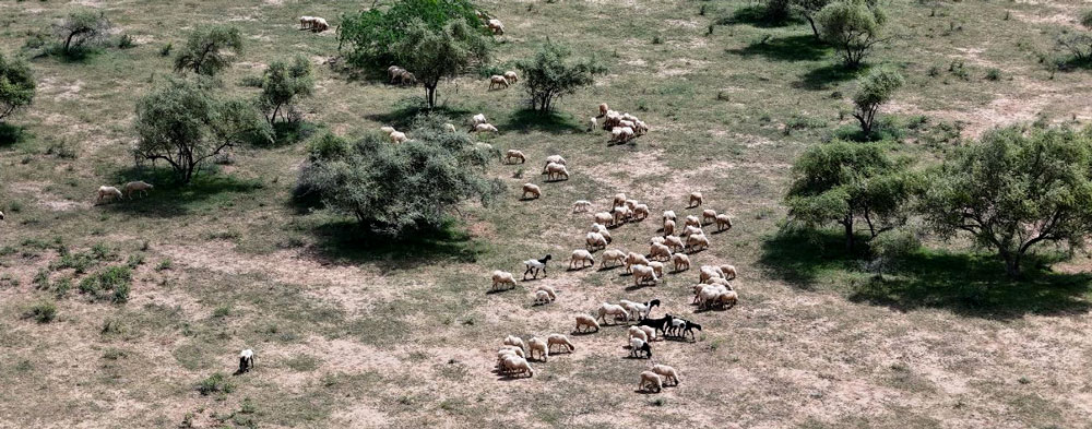 | | | | | | | | | |
| BACKGROUND The Deshnok Oran in Rajasthan is a community-managed, culturally and ecologically significant dryland. It supports diverse grasses and forbs, crucial for local livelihoods and biodiversity. Livestock, including camels, sheep, goats and buffaloes, depend on these grasslands. Additionally, the Oran serves as a biodiversity corridor, facilitating the movement of species like desert foxes, desert cats and spiny-tailed lizards. The Deshnok Oran’s grasslands also serve as carbon sinks, aiding soil preservation, groundwater recharge and climate resilience in the fragile desert landscape. PROBLEM For over six centuries, the Karani Mata Temple Trust has managed the 2,151-hectare Deshnok Oran. However, presently, the Oran faces several critical challenges. Privatisation and agricultural expansion have reduced grazing lands, intensifying the strain on the Oran. As the flora diminished, so did the habitat for local wildlife and livestock, threatening biodiversity and the livelihoods of the communities that depend on these ecosystems. The reduced grasslands have also led to the siltation of traditional waterbodies, forcing the local people to rely on canal water, increasing waterborne diseases and pushing the locals to turn to groundwater and rainwater. This project aims to revive the Deshnok Oran and identify and exemplify best practices in grassland restoration.
KEY PROJECT ACTIVITIES
· Identified a 50-hectare intervention area.
· Established a native grass and shrub nursery. · Create a fenced control plot of 10 hectares within the intervention
area to study the impact of grazing.
· Outplant grass and shrub species in the intervention area.
· Conduct biodiversity surveys to establish baseline data and monitor
project impacts and progress.
· Desilt traditional water-harvesting systems.
· Build local capacity for ecosystem monitoring and establish a
community-based biodiversity management committee.
EXPECTED OUTCOME The project aims to create a thorough grassland restoration strategy for the Deshnok Oran and execute it using water-efficient methods to enhance ecological resilience, livelihood security and biodiversity conservation. | | |
|
|
|
|---|
|
|
PROJECT Long-term Monitoring of Butterflies in the Eastern Himalaya (LMBPEH): A Citizen-science Approach by Sailendra Dewan, Rohit George, Aditya Pradhan and Pema Yangden | | | | | | | 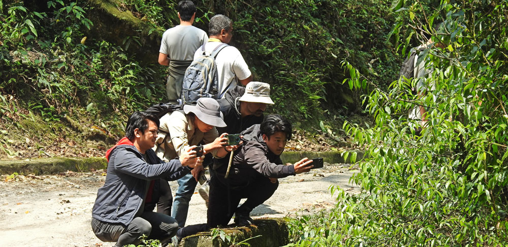 | | | | | | | | | |
| BACKGROUND Butterflies provide key ecosystem services as pollinators and are vital in the food chain. They serve as indicator species due to their reliance on vegetation and habitats, making them a flagship taxon for citizen science, creating nature awareness and ecotourism. The tropical and subtropical belts of the Himalaya are hotspots of butterfly diversity, home to a unique assemblage of rare and threatened species. These areas are a priority for butterfly conservation, but with only 6 sq. km of protected land below 1500 metres in Sikkim, conservation opportunities at lower elevations are limited. PROBLEM Habitat loss, pollution, pathogens and climate change have caused a 40% decline in insect populations, including butterflies, at a rate eight times faster than vertebrates. Monitoring has revealed population declines in Europe, the US and Asia. In the Himalaya, 28.37% of the species are of high conservation concern, and 74 species are listed as threatened. Many of these butterflies occur in Sikkim, Eastern Himalaya. The habitat of butterflies, especially in the tropical and subtropical belt, is undergoing rapid conversion to meet the demands of human population growth. Efforts are underway to document biodiversity in human-managed landscapes in addition to protected areas. Nonetheless, these initiatives should be transitioned into long-term monitoring programmes to draw more data, track changes, identify threats and develop robust conservation policies. Our project aims to collate long-term biodiversity records involving citizens, researchers and scientists, specifically targeting areas where human activities are prominent. The project will also provide a strong platform to raise awareness about the current threats to butterflies and their habitats.
OUTCOME • Establish groundwork for a long-term butterfly monitoring programme in the Eastern Himalaya.
• Generate a database of butterfly inventories and status to inform
conservation policies.
• Empower stakeholders through awareness and community engagement,
promoting stewardship and accelerating butterfly documentation.
• Engage citizen scientists, especially students, in documenting butterflies. | | |
|
|
|
|---|
|
|
PROJECT
Monitoring wintering harriers at a ‘super-roosting’ site in Velavadar National Park, India by T. Ganesh and Arjun Kannan |
|
|---|
|
| | | | | | 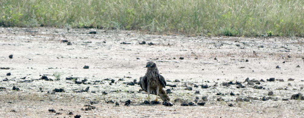 | | | | | | | | | |
| BACKGROUND
Monitoring migratory raptors in their non-breeding or wintering regions is challenging due to the large-scale nomadic movements they perform mainly following prey availability. A number of long-term raptor monitoring programmes worldwide have employed methods such as road surveys, counts at migration bottlenecks and roost counts, which have helped decode population trends of several raptor species. However, there is a dearth of such monitoring programmes in Asia, particularly in India, a major wintering site in the Central Asian Flyway for a number of raptor species that breed in Central Asia. PROBLEM
The 2023 report, State of India’s Birds, has highlighted that raptors, such as harriers that winter in arid and semi-arid open natural ecosystems like grasslands and savannas, show steep population declines. Previous studies that have monitored harriers at their roost sites across India have also shown similar trends. The reasons for the decline are unknown but could be due to unfavourable changes in their Indian wintering quarters. Harriers congregate on the ground communally at grassland roosting sites spread across their wintering range. This presents an opportunity to monitor them since they are also known to show high site fidelity over the years. One such major roosting site of harriers, considered the largest in India, is the Velavadar National Park (VNP), which records an exceedingly high number of roosting harriers. Since about 2500–3000 harriers congregate here during winter, this is also known as a harrier ‘super-roost’. Roger Clarke, in 2002, did a study that showed that harrier predation on locusts in croplands surrounding the VNP can be substantial, and farmers benefit by having the birds around. Velavadar, unlike many other grasslands in India, still holds farmlands in the surroundings where traditional non-intensive cropping is practised, and harriers actively forage in the sorghum and cotton crops. However, these can change as the surroundings of VNP are rapidly giving way to commercial development and pesticide-intensive farming. Recent studies and anecdotal observations at this site say that harrier roosting numbers halved in 2015 compared to the counts conducted in the 1990s.
OUTCOME
Our study focuses on monitoring harriers at VNP to understand the trends in harrier populations since the park constitutes the bulk of the birds that winter in India. We aim to build local capacity by employing and training local volunteers to undertake long-term monitoring of harriers. Parallelly, we will monitor the larger landscape around the park through remote sensing that will help correlate it with harrier numbers and understand how land-use change is affecting harriers. | | |
|
|
|
|---|
|
|
PROJECT Enabling Community Forest Management in Bastar, Chhattisgarh: Empowering communities towards sustainable forest management and livelihood enhancement by Anubhav Shori (District Coordinator), Santu Maurya, Rupchand Nag, Laxminath Kashyap, Bansingh Maurya, Somaru Baghel, Phulsingh Nag, Kamlesh Kashyap, Sukhdeo Baghel, Kamlu Poyam, Shruti Samanta, Shruti Mokashi and Sharachchandra Lele | | | | | | | 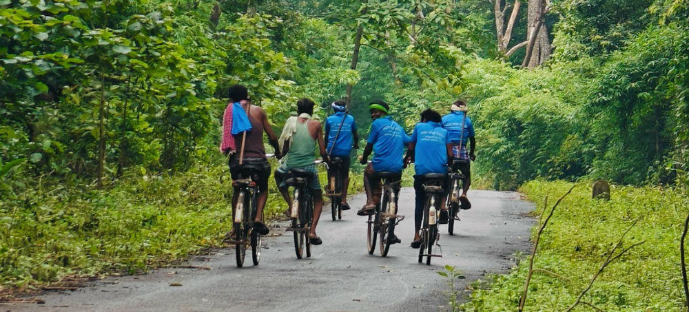 | | | | | | | | | |
| BACKGROUND Since 2021, ATREE has been striving to enhance capacities for the recognition of the rights of the local communities to collectively manage forest resources in Bastar, Chhattisgarh state, under the Community Forest Resource Rights (CFRR) provision of the Forest Rights Act 2006 (FRA). ATREE has trained local youth to assist in filing claims, trained over 100 government officials, engaged with 200+ villages across seven blocks in the district, and developed a web-GIS platform and the Aamcho CFR mapping application used in the claims process. To date, 56 villages have secured CFR rights over 54,292 hectares of forest.
While the title itself is a significant achievement, the actual realisation of rights comes from the implementation of management plans. ATREE initiated village-level workshops to build a grassroots understanding of collective management and developed a CFR management plan template to integrate conservation, access and livelihood enhancement in the forest management plans of the villages. Additionally, workshops were conducted for CFR Management Committees to enhance their administrative skills.
PROBLEM The main challenge now lies in enabling communities to engage in sustainable forest resource management (resource use, conservation, and restoration) through appropriate models that are community-led and village-specific. Additionally, communities must actively think about enhancing their livelihoods through the establishment of grassroots democracy.
OUTCOME In the first phase, three of the seven selected villages – Nagalsar, Dhudmaras and Gumalwada – successfully prepared and implemented their CFR management plans. All the villages are actively working on:
• Patrolling: Four villages continue to patrol their forest boundaries regularly.
• Regeneration: One village has independently completed plantation work on five hectares of degraded land.
• Livelihood Enhancement: Two villages have successfully launched eco-tourism initiatives and established clear rules for managing them. Dhudmaras, one of the selected villages, won the Best Tourism Award, highlighting the success of their forest rights and eco-tourism efforts.
• Convergence: We are assisting the villages in accessing various government schemes by engaging in ongoing discussions with relevant officials. Recently, the Forest Department approved ₹5 lakhs for eco-tourism development to Gram Sabha’s Eco Development Committee.
This progress reflects the communities' commitment to sustainable forest management and livelihood enhancement. | | |
|
|
|
|---|
|
|
PROJECT Exploring Association between Climate Change Related and Other Incidental Drowning Risks by Shrinivas Badiger, Sushmita, Yashodhara and Aman Gupta | | | | | | | 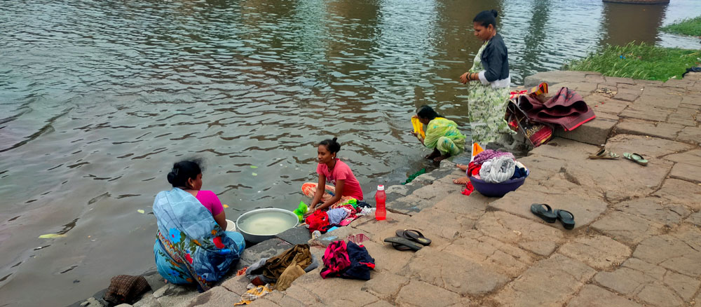 | | | | | | | | | |
| BACKGROUND Climate change threatens human health through a number of pathways. Of the immediate health impacts related to climate change, including injuries and deaths from extreme weather events, drowning poses a significant risk. Research into the epidemiology, risk factors and preventive strategies for unintentional drowning in low-income and middle-income countries has expanded significantly. Still, disaster and extreme weather-related drownings need a greater understanding of who is most vulnerable. Drowning accounts for over 250,000 deaths annually, with over 90% occurring in low- and middle-income countries. In these contexts, drowning often occurs while people go about their everyday essential activities, such as bathing, cleaning, travelling or fishing. India contributes significantly to the global burden of drowning, with national drowning deaths accounting for 17% of global unintentional drowning mortality. With a coastline of over 8000 km and extensive inland freshwater systems, a large proportion of India’s population is regularly exposed to water. Many waterbodies, such as traditional tanks, are located within or nearby community settings, particularly in rural areas. PROBLEM
The WHO describes drowning as an under-recognised threat to public health. Despite a number of drowning risk factors being common across India and numerous media sources reporting on drowning cases, little empirical data is available on the burden or context of drowning-related morbidity or mortality within the country. A better understanding of the context and trends of fatal and non-fatal drowning is required to inform appropriate policies and prevention strategies. The impact of climate change on drowning has been largely ignored. OUTCOME • Analyse databases and grey literature on risk factors to quantify the number of people who drown as a result of events related to climatic and non-climatic factors (e.g. extreme rainfall events, floods, cyclones etc.).
• Co-develop strategies aimed at prevention and mitigating the risk of drowning in India with partners and state departments.
• Share case study findings with the affected communities, disaster management authorities and other relevant state departments. | | |
|
|
|
|---|
|
|
PROJECT Biodiversity Knowledge Commons and Site-Specific Portals for Soliga Adivasi Community by Preeti Singh, Madegowda C., Siddappa Setty and Milind Bunyan | | | | | | |  | | | | | | | | | |
| BACKGROUND The Biodiversity Collaborative is a network of institutions focused on biodiversity science and conservation, advocating for the critical connection between biodiversity conservation, sustainable use and human well-being. The collaborative works on three key fronts: establishing a national-scale action plan through the National Mission on Biodiversity and Human Well-Being, generating public awareness of the role of biodiversity in societal well-being and leveraging digital technologies to promote biodiversity as a public good.
Aligned with these goals, ATREE is spearheading a series of site-specific portals in the Biligiri Rangaswamy Temple Tiger Reserve (BRT) Community Conservation Centre (CCC), Agasthyamalai CCC and Sikkim-Darjeeling landscapes. In the BRT CCC landscape, the initiative will curate over 30 years of research by ATREE on biodiversity conservation, sustainable development and the impact of the Forest Rights Act (FRA) on local communities, especially the Soliga Adivasis, in BRT and Malai Mahadeshwara (MM) Hills Wildlife Sanctuary. The data will serve as a comprehensive resource for local communities, especially the younger generation, to conserve biodiversity and empower local economies through sustainable use. PROBLEM Despite extensive research, much of the critical data on biodiversity conservation, forest resources, especially non-timber forest products, and sustainable development in these regions was not completely accessible to the local communities. Simultaneously, younger generations within Indigenous communities, particularly the Soligas, face challenges accessing cultural heritage resources, conservation and bioresource data. Bridging this gap through a platform that curates community-relevant information can help preserve biodiversity and empower local youth to engage with conservation and sustainable development. Not only will this help build the capacity of the younger generation, but it can also be vital for shaping conservation efforts, building social capital and supporting local economies.
OUTCOME • Biodiversity Knowledge Commons: The project will develop a comprehensive digital platform, facilitating efficient access to biodiversity datasets across diverse broad topics like farming systems, NTFPs, agroforestry, invasive species, and traditional knowledge. This effort would enable policymakers, researchers, and local communities to make informed decisions, promote conservation, and boost local bio-economies through nature-based solutions. • Citizen’s Portal on wild edibles of BRT and MM Hills: This portal will aggregate, curate, and disseminate detailed information on wild edibles, integrating data with other platforms like the India Biodiversity Portal (IBP). • Site-Specific Portal for BRT and MM Hills: ATREE will develop a site-specific portal focused on biodiversity conservation and sustainable development in the BRT and MM Hills regions. The portal will consist of community-requested data. • Conservation and Economic Sustainability: This initiative will document the ecological and cultural history of these landscapes, supporting the sustainable use of biodiversity resources while promoting socio-economic resilience. The focus will be on empowering local economies, enhancing livelihoods through biodiversity-based enterprises and creating a knowledge base to address climate change, ecological restoration, and health. | | |
|
|
|
|---|
|
You could create a huge impact, we look forward to your contribution |
|
|---|
|
ATREE, Royal Enclave, Sriramapura, Jakkur Post, Bangalore 560 064
Phone: +91-80-23635555 | www.atree.org | info@atree.org |
|
|
|
|---|
|
|
|